Remote sensing has revolutionized data collection and analysis across various fields, from environmental monitoring to urban planning. With advancements in technology, remote sensing techniques are becoming increasingly sophisticated, allowing researchers to gather and analyze data with unprecedented precision. In this comprehensive guide, we’ll explore the top 5 remote sensing techniques for gathering data.
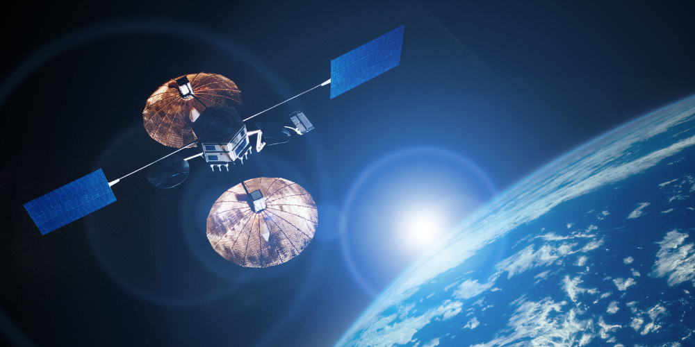
Satellite imagery involves capturing data from satellites orbiting Earth. These images provide a broad perspective on large areas, making them ideal for environmental monitoring, land-use planning, and disaster management.
Applications and Benefits
Satellite imagery is widely used in various fields due to its ability to cover vast areas and provide detailed, high-resolution images. Here are some key applications and benefits:
- Environmental Monitoring: Satellite images are crucial for tracking changes in the environment, such as deforestation, desertification, and melting ice caps. They help scientists monitor the health of ecosystems, track wildlife populations, and assess the impact of climate change.
- Land-Use Planning: Urban planners and policymakers use satellite imagery to manage land resources efficiently. It helps in mapping urban expansion, agricultural activities, and infrastructure development. This data is essential for making informed decisions about land use and zoning.
- Disaster Management: In the event of natural disasters such as hurricanes, earthquakes, and floods, satellite imagery provides real-time data to assess the extent of damage. This information is vital for coordinating rescue and relief efforts, as well as for planning reconstruction.
- Agriculture: Farmers and agricultural experts utilize satellite imagery to monitor crop health, soil conditions, and water usage. This technology enables precision farming, leading to higher yields and more sustainable agricultural practices.
- Climate Studies: Researchers use satellite data to study weather patterns, atmospheric conditions, and climate change. This information is crucial for developing climate models and predicting future climate scenarios.
How It Works
Satellites equipped with various sensors capture images in different spectral bands, including visible light, infrared, and radar. These sensors detect energy reflected or emitted from the Earth’s surface and convert it into digital images. The data is then processed and analyzed to extract valuable information.
Advantages
- Wide Coverage: Satellites can capture images of large areas in a single pass, making it possible to monitor extensive regions quickly and efficiently.
- High Resolution: Modern satellites provide high-resolution images, allowing for detailed analysis and accurate mapping.
- Frequent Updates: Satellites can revisit the same location at regular intervals, providing up-to-date information for dynamic monitoring.
Challenges
While satellite imagery offers numerous benefits, it also faces some challenges:
- Cost: The development, launch, and maintenance of satellites are expensive, making satellite imagery a costly resource.
- Cloud Cover: Weather conditions, such as cloud cover, can obstruct satellite images, reducing their effectiveness in certain regions.
- Data Processing: Analyzing the vast amount of data generated by satellites requires sophisticated software and expertise.
Satellite imagery is a powerful tool for gathering and analyzing data over large areas. Its applications in environmental monitoring, land-use planning, disaster management, agriculture, and climate studies make it indispensable for researchers and policymakers. Despite its challenges, the advantages of satellite imagery far outweigh its limitations, making it a critical component of modern remote sensing technology.
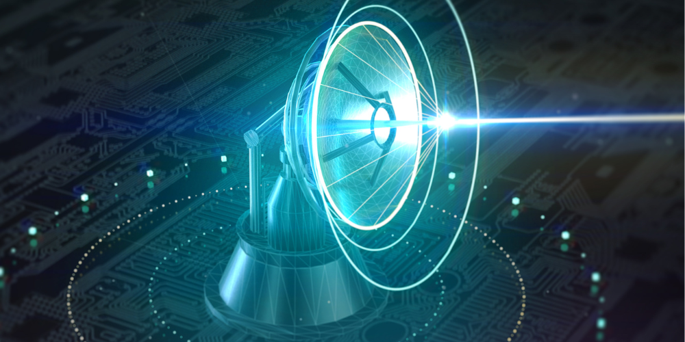
LiDAR (Light Detection and Ranging) is a remote sensing technique that uses laser pulses to measure distances between the sensor and the Earth’s surface. By analyzing the time it takes for the laser to return, LiDAR systems can create highly accurate 3D models of terrain and objects.
Applications and Benefits
LiDAR technology is valued for its precision and versatility, making it useful across a wide range of fields. Here are some of the primary applications and benefits:
- Topographic Mapping: LiDAR is widely used for creating detailed topographic maps. It can accurately capture the shape and elevation of the land surface, making it essential for geological studies, civil engineering, and construction projects.
- Forestry Management: LiDAR helps in mapping forest structure, assessing biomass, and monitoring changes in forest cover. It enables forest managers to inventory tree species, evaluate forest health, and plan sustainable forestry practices.
- Urban Planning: Urban planners use LiDAR data to model city landscapes, plan infrastructure, and manage urban growth. It provides precise information on building heights, road networks, and land use, aiding in effective urban development.
- Archaeology: LiDAR is revolutionizing archaeological surveys by revealing hidden structures beneath dense vegetation. It can uncover ancient ruins, burial mounds, and other cultural artifacts without disturbing the site.
- Disaster Management: LiDAR’s ability to generate high-resolution elevation models is crucial for flood risk assessment, landslide mapping, and earthquake impact analysis. It helps in predicting disaster-prone areas and planning mitigation strategies.
- Coastal Zone Management: LiDAR is used to map coastal areas and monitor changes in shoreline, dune, and beach morphology. It aids in coastal erosion studies, habitat mapping, and maritime navigation.
How It Works
LiDAR systems consist of a laser, a scanner, and a GPS receiver. The laser emits pulses of light towards the ground. When these pulses hit an object or the surface, they bounce back to the sensor. By measuring the time it takes for the pulses to return, the system calculates the distance to the object. These distance measurements are then used to create detailed 3D models of the landscape.
Advantages
- High Accuracy: LiDAR provides extremely precise measurements, making it ideal for applications requiring detailed and accurate terrain data.
- Rapid Data Collection: LiDAR can cover large areas quickly, providing comprehensive data in a short amount of time.
- Penetration Capability: LiDAR can penetrate vegetation and provide ground surface information even in densely forested areas.
Challenges
While LiDAR is a powerful tool, it also faces certain challenges:
- Cost: LiDAR systems and data processing are expensive, making it a costly option for some projects.
- Data Complexity: The vast amount of data generated by LiDAR requires advanced processing techniques and significant storage capacity.
- Weather Sensitivity: LiDAR performance can be affected by weather conditions such as heavy rain, fog, or snow, which can interfere with laser pulses.
LiDAR is a highly accurate remote sensing technology that has transformed various fields by providing detailed 3D models of terrain and objects. Its applications in topographic mapping, forestry management, urban planning, archaeology, disaster management, and coastal zone management highlight its versatility and importance. Despite its cost and complexity, the benefits of LiDAR make it an invaluable tool for researchers and professionals seeking precise and comprehensive spatial data.
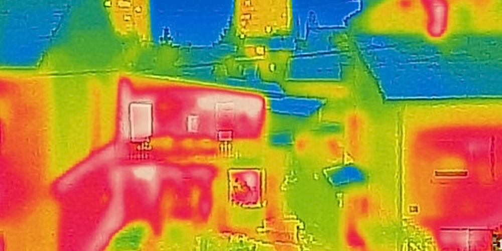
Hyperspectral imaging captures data across hundreds of narrow spectral bands, allowing for the identification and analysis of materials based on their spectral signatures. This technique provides detailed information about the composition and properties of objects and surfaces, making it an invaluable tool in various scientific and industrial applications.
Applications and Benefits
Hyperspectral imaging’s ability to capture a broad spectrum of light, far beyond what the human eye can see, opens up numerous possibilities for research and practical applications. Here are some key applications and benefits:
- Agriculture: Hyperspectral imaging is used to monitor crop health, detect diseases, and assess soil properties. By analyzing the spectral signatures of plants, farmers can identify nutrient deficiencies, pest infestations, and optimal harvest times, leading to more efficient and sustainable agricultural practices.
- Environmental Monitoring: This technology helps in monitoring pollution levels, assessing water quality, and studying ecosystems. For instance, hyperspectral imaging can detect harmful algal blooms in water bodies, monitor deforestation, and track changes in land use.
- Mineralogy and Geology: Hyperspectral imaging is used to identify minerals and map geological features. It helps in exploration and mining by providing detailed information about mineral composition and distribution, aiding in the discovery of new resources.
- Medical Diagnostics: In the medical field, hyperspectral imaging is used for non-invasive diagnostics. It can detect early signs of diseases such as cancer, monitor wound healing, and assess tissue health by analyzing the spectral signatures of biological tissues.
- Food Quality Control: Hyperspectral imaging ensures food safety and quality by detecting contaminants, assessing ripeness, and identifying defects in fruits, vegetables, and other food products. It helps in maintaining high standards in the food industry.
- Military and Defense: This technology is used for surveillance, target identification, and material detection. Hyperspectral imaging can identify camouflage, detect hidden objects, and distinguish between different types of materials, enhancing situational awareness.
How It Works
Hyperspectral imaging involves capturing images at many different wavelengths across the electromagnetic spectrum. A hyperspectral sensor collects data in contiguous spectral bands, creating a spectral profile for each pixel in the image. These spectral profiles, or signatures, provide detailed information about the materials being observed. Advanced algorithms are then used to analyze the data and identify the unique spectral characteristics of various substances.
Advantages
- Detailed Information: Hyperspectral imaging provides rich, detailed data that can reveal subtle differences in material composition and properties.
- Non-Destructive: This technique is non-invasive and non-destructive, making it ideal for applications where preserving the integrity of the subject is crucial.
- Versatile Applications: Hyperspectral imaging is applicable in a wide range of fields, from agriculture and environmental science to medicine and defense.
Challenges
Despite its advantages, hyperspectral imaging faces several challenges:
- Data Volume: The large amount of data generated by hyperspectral sensors requires substantial storage capacity and powerful processing capabilities.
- Cost: High-resolution hyperspectral sensors and the associated data analysis tools can be expensive, limiting their accessibility for some users.
- Complexity: Analyzing hyperspectral data requires specialized knowledge and advanced algorithms, making it a complex field that demands expertise.
Hyperspectral imaging is a powerful remote sensing technique that provides detailed spectral information about materials and surfaces. Its applications in agriculture, environmental monitoring, mineralogy, medical diagnostics, food quality control, and defense underscore its versatility and importance. While it faces challenges such as high data volume, cost, and complexity, the benefits of hyperspectral imaging make it an essential tool for researchers and professionals seeking in-depth analysis and precise identification of materials.
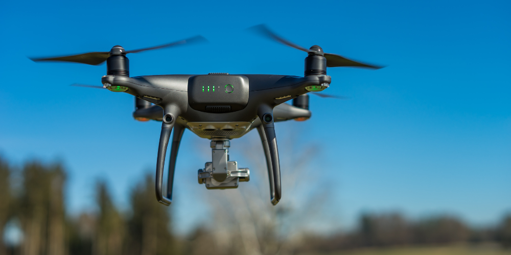
Unmanned Aerial Vehicles, commonly known as drones, are increasingly used in remote sensing to capture high-resolution aerial imagery and collect various types of data. UAVs offer flexibility and precision in data collection, making them an invaluable tool across multiple industries and research fields.
Applications and Benefits
UAV technology has revolutionized data collection by providing a versatile and cost-effective means of capturing detailed imagery and other types of data. Here are some of the primary applications and benefits of UAVs:
- Agriculture: Drones are used for crop monitoring, assessing plant health, and precision farming. Equipped with various sensors, they can detect nutrient deficiencies, pests, and diseases, helping farmers optimize their practices and increase yields.
- Environmental Monitoring: UAVs are utilized to monitor wildlife, track changes in ecosystems, and survey natural habitats. They can access remote or difficult-to-reach areas, providing detailed data for conservation efforts and environmental assessments.
- Disaster Management: In disaster response, drones offer rapid assessment of affected areas, providing real-time data to aid in rescue operations, damage assessment, and recovery planning. They are especially useful in areas inaccessible to traditional vehicles.
- Urban Planning and Construction: Drones provide accurate aerial surveys for urban development projects, infrastructure inspection, and construction site monitoring. They help in creating detailed maps, tracking progress, and identifying potential issues.
- Mining and Geology: UAVs are used for mineral exploration, mapping geological features, and monitoring mining operations. They provide high-resolution imagery and data that can help identify mineral deposits and assess site conditions.
- Forestry Management: Drones assist in forest mapping, monitoring tree health, and assessing forest biomass. They help in managing forest resources, tracking deforestation, and planning reforestation projects.
- Archaeology: UAVs enable archaeologists to survey large areas quickly, identifying potential excavation sites and mapping archaeological features. They provide a non-invasive method to explore and document historical sites.
How It Works
UAVs are equipped with various sensors and cameras that capture high-resolution imagery and other types of data. These sensors can include optical cameras, thermal imagers, LiDAR, and multispectral sensors. Drones are controlled remotely or programmed to follow a predefined flight path, collecting data as they fly over the target area. The captured data is then processed and analyzed using specialized software to extract valuable information.
Advantages
- Flexibility: UAVs can be deployed quickly and can access areas that are difficult or dangerous for humans to reach, providing flexibility in data collection.
- Cost-Effective: Drones are generally more affordable than manned aircraft or satellite imagery, making them a cost-effective solution for various applications.
- High Resolution: UAVs can capture high-resolution imagery, providing detailed and accurate data for precise analysis.
- Real-Time Data: Drones can provide real-time data, which is crucial for time-sensitive applications like disaster response and monitoring dynamic environments.
Challenges
Despite their numerous benefits, UAVs also face certain challenges:
- Regulatory Issues: The use of drones is subject to regulations and restrictions that vary by country and region. Operators must comply with legal requirements, which can limit where and how UAVs can be used.
- Weather Dependency: UAV operations can be affected by adverse weather conditions such as high winds, rain, or snow, which can limit their effectiveness and safety.
- Battery Life: Drones have limited flight times due to battery constraints, requiring frequent recharging or battery replacement for extended missions.
- Data Management: The large volumes of data generated by UAVs need to be stored, processed, and analyzed, which can be resource-intensive and require specialized skills.
Unmanned Aerial Vehicles (UAVs) are a versatile and powerful tool for remote sensing, offering flexibility, precision, and cost-effectiveness in data collection. Their applications in agriculture, environmental monitoring, disaster management, urban planning, mining, forestry, and archaeology highlight their wide-ranging impact. Despite challenges such as regulatory issues, weather dependency, and battery life, the advantages of UAVs make them an indispensable asset for modern data collection and analysis.
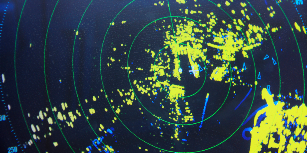
Radar remote sensing uses radio waves to detect and measure objects and surfaces. Unlike optical remote sensing, radar can penetrate clouds and operate in various weather conditions, providing consistent data.
Applications and Benefits
Radar remote sensing is highly versatile and has numerous applications across various fields due to its ability to operate in diverse conditions and provide detailed data. Here are some of the primary applications and benefits:
- Weather Monitoring and Forecasting: Radar is extensively used in meteorology to track weather patterns, monitor storms, and predict rainfall. Weather radar systems can detect precipitation, storm intensity, and movement, which are crucial for accurate weather forecasting and early warning systems.
- Agriculture: Radar remote sensing helps in soil moisture monitoring, crop mapping, and assessing crop conditions. By providing data on soil moisture levels, radar assists farmers in optimizing irrigation practices and improving water management.
- Geology and Earth Sciences: Radar is used to study geological structures, monitor land deformation, and detect subsurface features. It is particularly valuable in earthquake research, volcano monitoring, and landslide detection, providing insights into ground movement and stability.
- Environmental Monitoring: Radar assists in monitoring deforestation, wetland mapping, and coastal zone management. It helps in tracking changes in land use, assessing habitat conditions, and managing natural resources effectively.
- Urban Planning: Urban planners use radar data to monitor infrastructure, assess land subsidence, and plan city expansions. It provides detailed information on building structures, road networks, and urban growth patterns.
- Disaster Management: Radar remote sensing is vital in disaster response and management. It can detect flood extents, assess damage after natural disasters, and monitor areas prone to hazards such as tsunamis and hurricanes, aiding in timely and effective response strategies.
- Military and Defense: Radar technology is used for surveillance, reconnaissance, and target detection. It can identify and track objects, monitor borders, and provide critical information for defense operations.
How It Works
Radar systems emit pulses of radio waves towards the target area. When these waves encounter an object or surface, they are reflected back to the radar sensor. By measuring the time it takes for the radio waves to return and analyzing the strength and phase of the reflected signals, radar systems can determine the distance, shape, and material properties of the target.
There are different types of radar remote sensing techniques, including:
- Synthetic Aperture Radar (SAR): SAR creates high-resolution images by combining multiple radar pulses taken from different positions. It is commonly used for detailed mapping and analysis of the Earth’s surface.
- Interferometric Synthetic Aperture Radar (InSAR): InSAR measures ground deformation by comparing radar images taken at different times. It is particularly useful for monitoring land subsidence, earthquake-induced ground movement, and glacier dynamics.
Advantages
- All-Weather Capability: Radar can operate in all weather conditions, including rain, fog, and snow, providing reliable data when optical sensors may fail.
- Day and Night Operation: Radar systems can capture data both day and night, unaffected by light conditions.
- Penetration Ability: Radar waves can penetrate through vegetation, soil, and certain structures, enabling the detection of subsurface features.
Challenges
Despite its numerous advantages, radar remote sensing also faces certain challenges:
- Complex Data Interpretation: Radar data can be complex to interpret, requiring advanced processing techniques and specialized knowledge.
- High Costs: High-resolution radar systems and data processing can be expensive, limiting their accessibility for some applications.
- Limited Availability: Not all areas have comprehensive radar coverage, and accessing high-quality radar data may be challenging in some regions.
Radar remote sensing is a powerful technology that uses radio waves to detect and measure objects and surfaces. Its ability to operate in all weather conditions, day and night, and penetrate through various materials makes it an invaluable tool in weather monitoring, agriculture, geology, environmental monitoring, urban planning, disaster management, and defense. Despite challenges such as complex data interpretation, high costs, and limited availability, the advantages of radar remote sensing make it an essential component of modern remote sensing technologies.


